Google Map Style

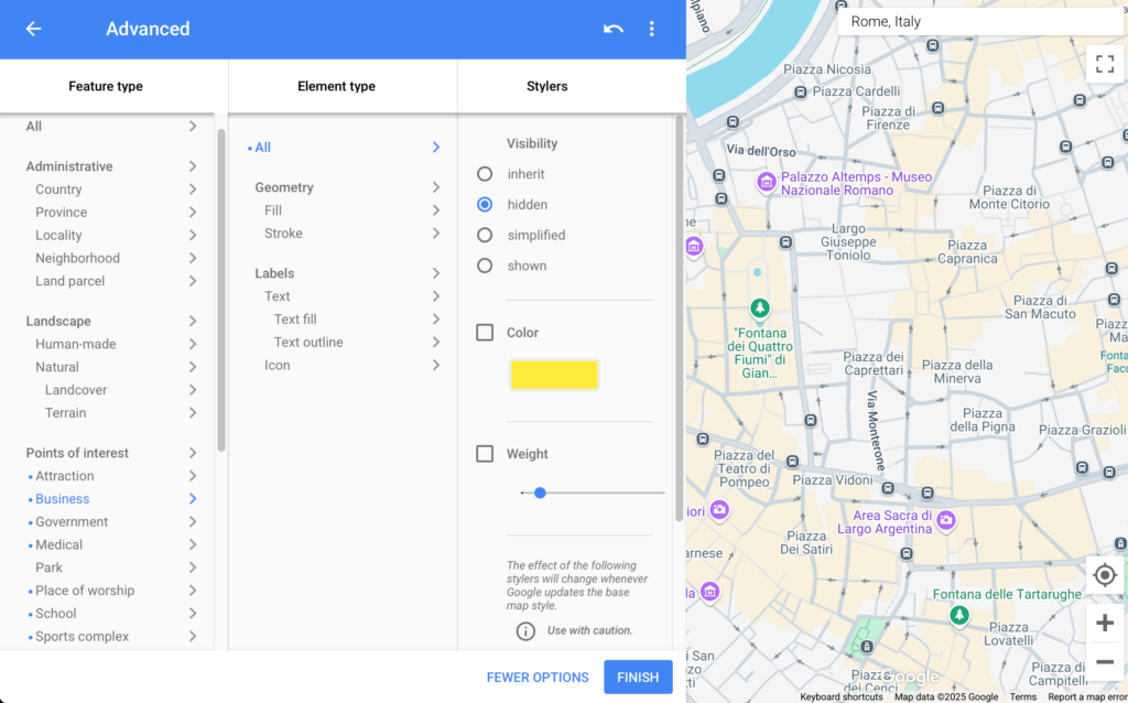
Store Locator Plus® Professional subscriptions support the  Google map style rules. These rules let you control the “inner style” of the map itself. You can turn off built-in Google map icons, change the width or roads, change the font size of various labels. Some styles will even change the color of the land and water bodies if you are truly looking to customize the map style to better match your brand. You will find some basic examples of these JSON settings below or you can use the Google styling wizard to create your own custom look and feel.

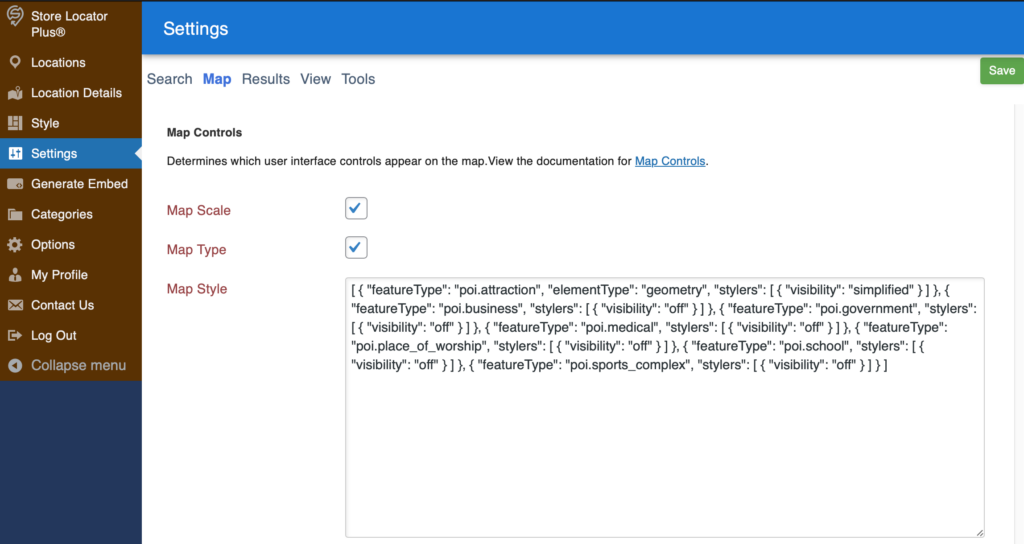
Changing The Google Map Style Setting

Settings > Map > Map Style

Accessing Settings | Map | Map Style on the Store Locator Plus® 2025 SaaS platform.

Go to the Legacy Map style wizard to generate the JSON value to copy and paste into this field.

Google Map Style Wizard

The value of this entry is a Google Maps JSON style string.  Some of our Plugin Styles in the Style Gallery will set this for you.

Map Settings for Store Locator Plus®

Under the menu for SLP / Settings /Map  :

The settings contained in the map panel will change the functionality of the map domain, center map, zoom and appearance.

The following settings are available to manage functionality for both WPSLP stand alone plug-in and MySLP SaaS managed service..

At Startup

  • Center Map:   This is where you enter an address, or a state, or a location or  a specific latitude and longitude to be displayed as the initial focus for the Map.   If nothing is entered in this box , the default will be the center of the United States .   Google map has determined the center of  United States to  be somewhere in Kansas.  Example:  See Google Localizing the Map:  The geocodes “Toledo” based on the default region (US) to “Toledo, Ohio”  or  one which biases results based on a region set to ES (Spain) to “Toledo, Spain.
  • Center Latitude Fallback: Center Longitude Fallback:  These are the latitude/longitude settings  that will be called if the Google server is “busy” or offline and not able to geocode or “call” to load your locations.  If you reset to blank it will fill in with the Center latitude/longitude of the map domain you have chosen.    You can have a different Lat/long fallback  then your map domain or center map if you  choose.    An image of your fallback will  be displayed